
Imprint: The content of this blog entry is based on VR experiments in the context of projects carried out in the scope of the authors masters degree studies at FHNW University of Applied Sciences and Arts Northwestern Switzerland under the supervision of Prof. Dr. Doris Agotai.
Jeremy Bailenson, founding director of Stanford University’s Virtual Human Interaction Lab, states in his recent publication that “VR is about exploration whereas storytelling is about control” [1]. Yet even while striving for offering the highest degree of freedom by handing full system control over to the user and allowing him/her to explore the virtual (data) space at is own discretion, the user needs some support for orientation, navigation and wayfinding to take advantage of this freedom, so that the exploration process may not solely be based on serendipity and the vastness of the data space doesn’t feel like a maze. .
Localization, wayfinding and navigation
The authors of “Understanding Virtual Reality” define navigation in VR as “the way of traveling through the space” and wayfinding as “knowing where you want to go” [2]. In the context of exploration one might need go even one step further back, namely knowing where your are. The term localization is used to determine the user’s current position within the virtual space and give him/her a system of reference that will be an assistance for the continuation of the exploration journey.
Some practical wayfinding aids for localization and navigation include
- (world) maps provide a mental picture that is deeply rooted in the user’s mind. Information on the current position such as the country the user is located in serve as a trigger to activate existing knowledge about the surrounding.
- offering a system of reference such as geographical coordinates.
- orientation aid via the indication of true north or placing a compass at the user’s disposal.
- hints such as leaving bread crumbs, some kind of guideposts or punctual instrumented guidance.
- marking spots that have been popular with other users, because insight on an individual level can be gained from information that might not be new to other members of the community.
The purpose of such measures is to foster the discovery of insight by offering light guidance in the individual exploration process without reducing the freedom of choice of the user.
Localization in the context of this project
While the user observes the data space from the bird’s eye perspective in our scenario, orientation is obvious, yet while flying over the world, the precise corresponding location on the ground might not be so obvious. Plus the real challenge is to keep orientation when the user switches perspective to ground level view. Support in this matter can either be offered directly within the virtual world, for instance by indicating the current location by the means of an avatar or marker on the ground, visually highlighting the underlying corresponding country or placing a label on it. Another approach that separates this additional information layer from the actual data space would be some kind of cockpit or control center, that provides the user with facts such as the geo coordinates of the current position, corresponding country, “flight” altitude, etcetera. In addition to localization related facts a summary of further relevant information could be offered on demand. This could include what filters have been applied to the currents selection and how many items are included as a result.
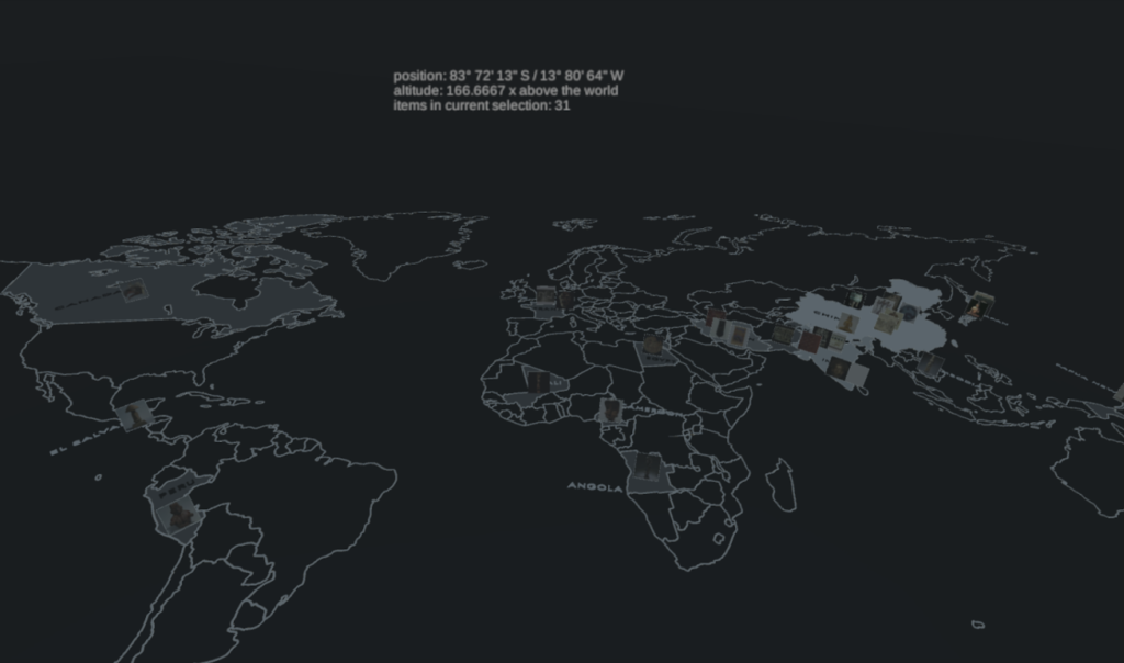
Figure 1: The prototype of the worldmap data exploration prototype offers a control center with localization related facts and a summary of other relevant information to the user.
[1] Bailenson, Jeremy (2018): “Experience on Demand: What Virtual Reality is, how it works and what it can do”. W. W. Norton & Company, New York, USA.
[2] William R. Sherman, Alan B. Craig (2003): “Understanding Virtual Reality”. Morgan Kaufmann Publishers, San Francisco, CA, USA.